Score
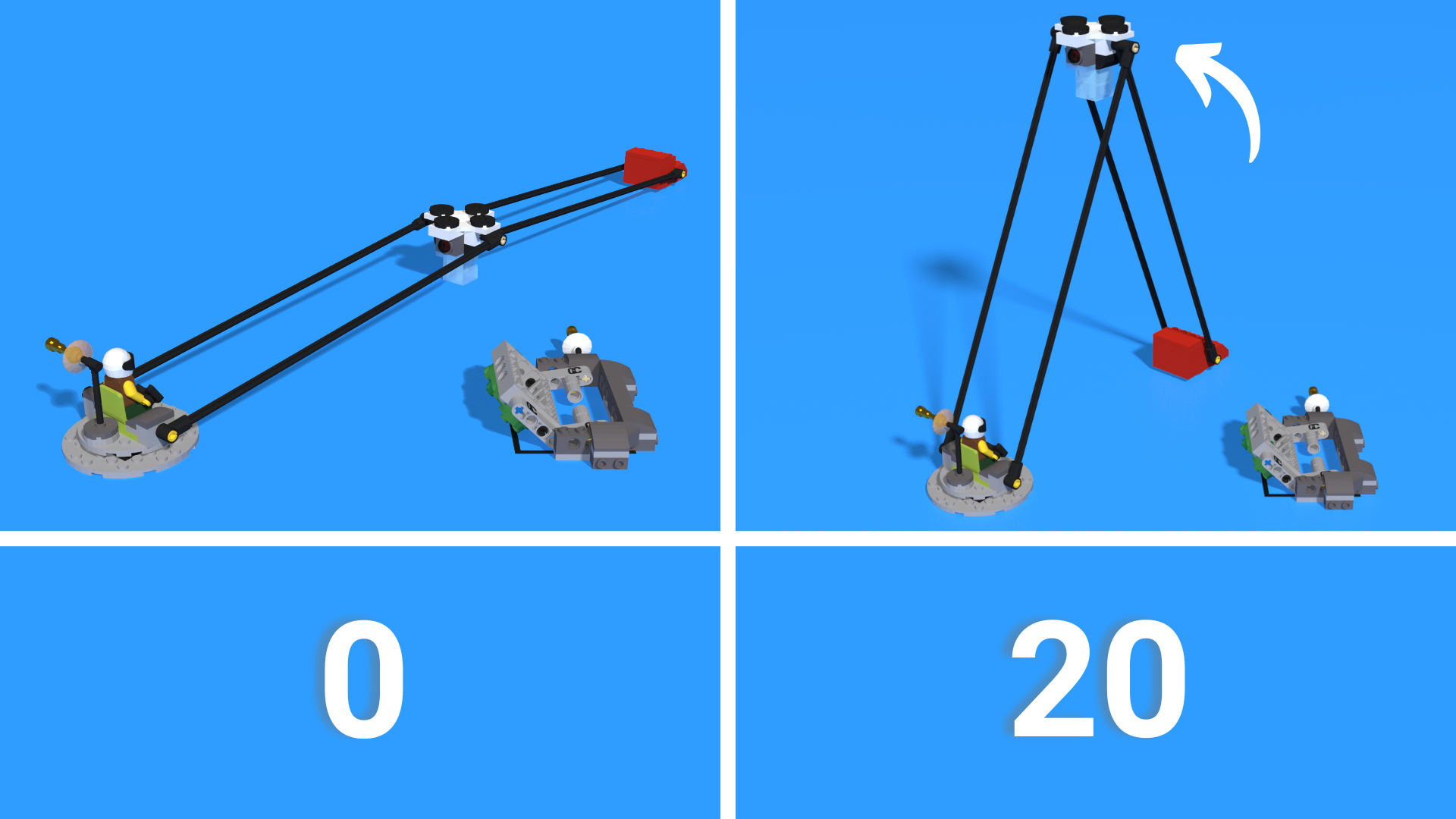
- Drone is no longer touching the mat: 20
-
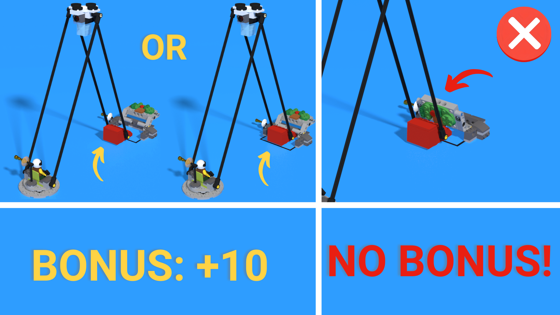
Bonus: and the LiDAR map is completely flipped over, with the scan marker at least partly in the survey area: 10 added
FLLCasts Tip
This mission is convenient to run from the left launch area. To reach the Scan Marker (the red block), use either the yaw/gyro sensor or the wall for alignment. Then push the Scan Marker so that it raises the drone.
For maximum points, the Scan Marker needs to finish under the LiDAR Map and help flip it. A typical self-aligning attachment may be difficult to use because the satellite dish on the LiDAR Map sits only about half a LEGO unit above the mat, leaving very little clearance. The robot therefore needs accurate positioning, or an attachment that can correct the Scan Marker’s position or align against the back of the model.
You can rotate the robot to place the Scan Marker under the LiDAR Map, but if the robot has been driving while rubbing against the wall, check that it still has enough room to make the left turn. Also, the Scan Marker does not have to flip the LiDAR Map itself. The robot can push the Scan Marker at least partly into the survey area and flip the LiDAR Map with a different part of the attachment; the two actions do not have to happen at the same time.
To save time, your team may choose to skip the bonus, simply push the Scan Marker forward far enough to raise the drone reliably, and return quickly to home. One idea worth testing on a real table is whether the Scan Marker can catch safely against the table wall while the drone is being lifted.